
At SkyBit Drone Services, we deliver stunning, professional aerial photography, videography and mapping to help elevate your business.
Whether you’re a real estate agent showcasing a home, a construction manager documenting progress at a job site, or a small business creating marketing visuals, our FAA Part 107-certificated remote UAS pilots combine technical precision with cinematic style to capture the imagery and data you need. Our pilots are insured, and operate in a safety-first mindset.
Based in Bonney Lake and serving Pierce and King Counties, Skybit is your resource when you value precision, professionalism, quality and consistency. We are not hobbyists–we are professionals who take great pride in staying ahead of the latest developments in aerial technology and leveraging every available tool to help elevate your business.
Professional Aerial Imagery and Data
-
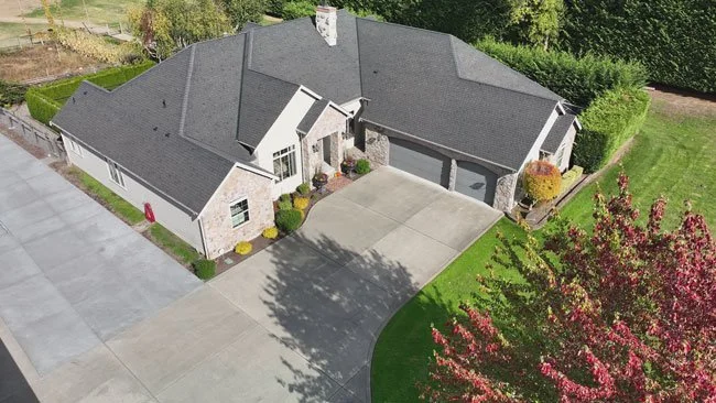
Real Estate Photo Shoots
Aerial photography, captured via drones, delivers a "wow" factor that ground-level shots simply can't match. Aerial shots create immediate visual intrigue, and have been shown to increase listing views by up to 68% compared to standard photos. By showcasing hard-to-capture features (e.g., expansive backyards or proximity to landmarks), aerial imagery reduces buyer hesitation. This makes buyers 65% more likely to schedule in-person showings, turning passive scrollers into active prospects.
Aerial photography isn't an expense—it's an investment that pays for itself through quicker closes and bigger paydays.
Let us help you elevate your brand and stand out in a crowded market!
-
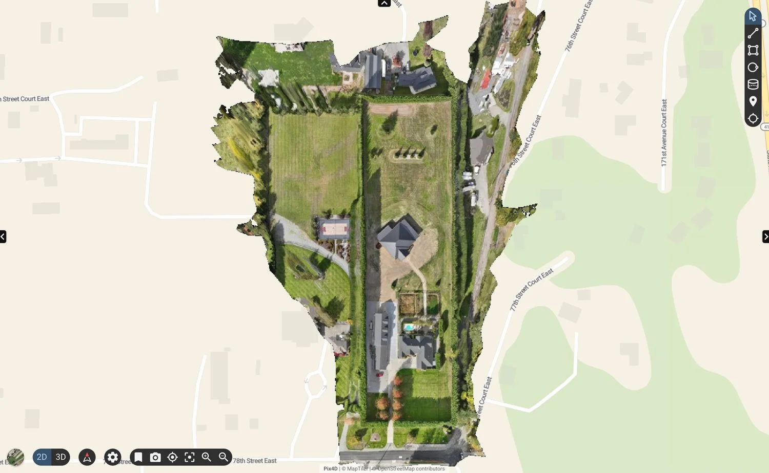
Aerial Mapping
We deliver high-precision aerial mapping solutions designed for construction, agriculture, land management and more. Using enterprise-grade RTK drones and advanced photogrammetry software, we capture ultra-detailed geospatial data to produce accurate, centimeter-level maps and 3D models—ideal for tracking job site progress, planning agricultural operations, and visualizing terrain. Our mapping outputs provide powerful insights that help clients measure, plan, and communicate with confidence.
-
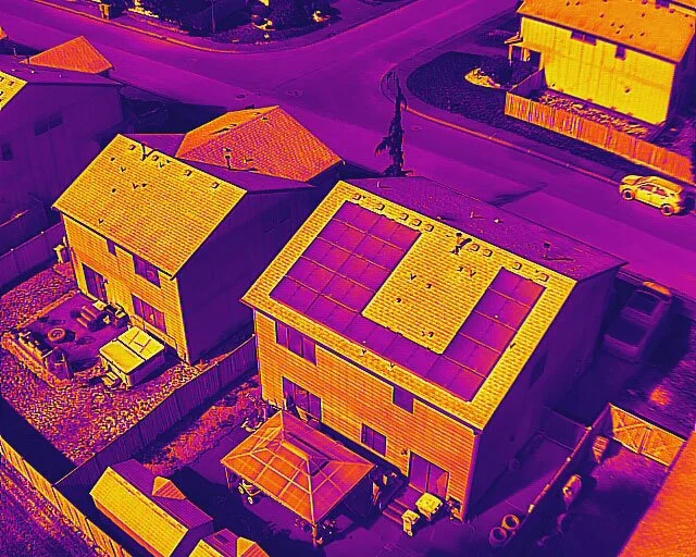
Thermal Imaging
We use advanced drone thermal imaging technology to reveal what the eye just can’t see. Our thermal cameras detect subtle heat variations to help identify hidden hotspots, locate people and animals in low-light conditions, and uncover temperature anomalies in large areas such as roofs, fields, job sites. Whether you’re managing property, wildlife, infrastructure or agriculture, our aerial thermal imaging provides a fast, non-invasive way to visualize and understand thermal patterns—helping you make smarter, safer decisions without ever setting foot on site.
About our Company and Founder
SkyBit delivers cutting-edge UAV aircraft solutions to empower industry leaders with the tools, media and data they need to excel. Our commitment to precision and customer satisfaction sets us apart as a trusted partner in aerial technology services.
Our Founder, Jason Farrell, is a Pacific Northwest native who spent 24 years developing and launching cellular connectivity gadgets of all kinds. Most recently, he was a founding member of a small team that incubated and scaled T-Mobile’s 5G fixed wireless broadband internet service, helping to transform it from a niche offering into a major disruptor in the U.S. market, serving millions of customers in underserved rural and suburban areas, and playing a key role in bridging the digital divide.
After helping launch T-Mobile Home Internet and connecting 7.3 million homes by mid-2025, Jason knew it was time for a new adventure. An unmanned aircraft and interactive media enthusiast for years, he left wireless behind for open skies: SkyBit Drone Services was born. Today’s drone industry is booming—$83 billion by 2025, with aerial inspections and mapping transforming construction, farming, and more. SkyBit brings that innovation to you, offering precise, AI-powered drone solutions to capture exacting data and stunning imagery.
Let’s elevate your projects and your brand to new heights together!