Services & Pricing
Investing in professional drone services can truly elevate your business, providing stunning aerial photography for real estate listings that captivate buyers or precise geospatial mapping for construction projects that streamline planning and execution.
While costs for these specialized services generally range from $300 to $1,500 for real estate shoots and $2,000 to $10,000 for mapping endeavors—depending on the project's size, complexity, and location—our tailored solutions deliver exceptional value that pays dividends in efficiency and results. Thermal imaging usually falls in the $200 to $800 range for small-scale residential jobs, whereas larger jobs can increase cost significantly.
Flight time, the size of mission area, advanced imaging requirements and post-processing work all affect pricing - the best way for us to set a fair price is to talk to you and fully understand your requirements. Our goal is to find a right fit for your unique needs that delivers better value than our competition.
For a limited time, we're offering exclusive introductory rates to new clients, so don't miss this opportunity to soar ahead of the competition at a fraction of the usual investment. Call or message us now for your free consultation and let's customize a plan that lifts your operations to new heights!
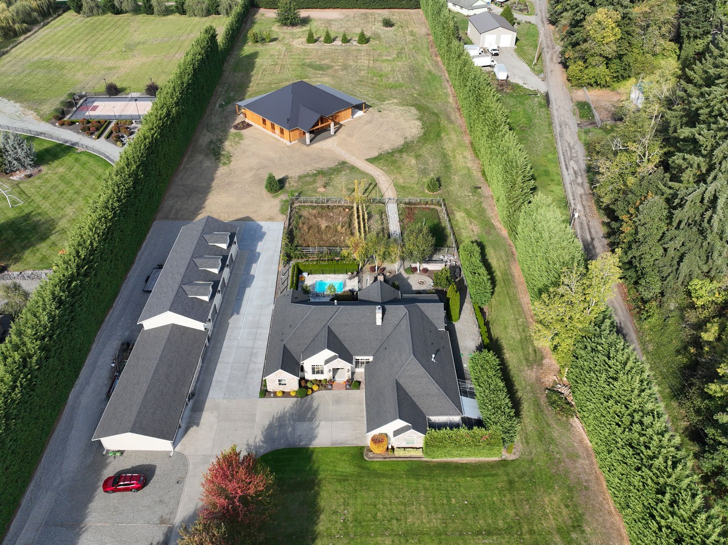
Real Estate Photography and Videography
Aerial photography, captured via drones, delivers a "wow" factor that ground-level shots simply can't match. Aerial shots create immediate visual intrigue, and have been shown to increase listing views by up to 68% compared to standard photos. By showcasing hard-to-capture features (e.g., expansive backyards or proximity to landmarks), aerial imagery reduces buyer hesitation. This makes buyers 65% more likely to schedule in-person showings, turning passive scrollers into active prospects.
Aerial photography isn't an expense—it's an investment that pays for itself through quicker closes and bigger paydays.
Let us help you elevate your brand and stand out in a crowded market!
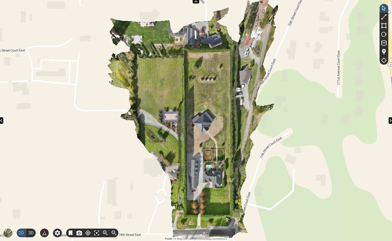
Aerial Mapping
We deliver high-precision aerial mapping solutions designed for construction, agriculture, land management and more. Using enterprise-grade RTK drones and advanced photogrammetry software, we capture ultra-detailed geospatial data to produce accurate, centimeter-level maps and 3D models—ideal for tracking job site progress, planning agricultural operations, and visualizing terrain. Our mapping outputs provide powerful insights that help clients measure, plan, and communicate with confidence.
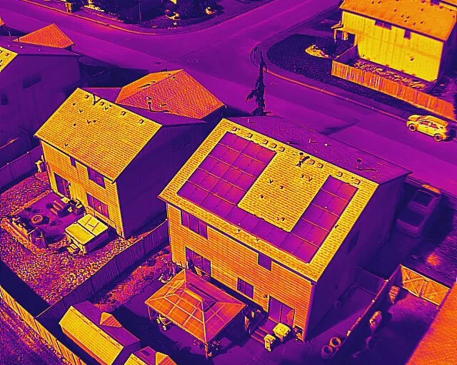
Thermal Imaging & Inspection
We use advanced drone thermal imaging technology to reveal what the eye just can’t see. Our thermal cameras detect subtle heat variations to help identify hidden hotspots, locate people and animals in low-light conditions, and uncover temperature anomalies in large areas such as roofs, fields, job sites. Whether you’re managing property, wildlife, infrastructure or agriculture, our aerial thermal imaging provides a fast, non-invasive way to visualize and understand thermal patterns—helping you make smarter, safer decisions without ever setting foot on site.